Category: Sedona
Sedona

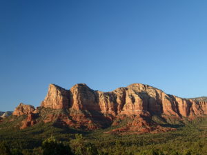
Sedona is the center of what is known as “Red Rock Country.” The scenery is like an oasis when approaching from Phoenix. Driving north through the desert, seeing your first glimpse of the red rock sandstone with green vegetation sprinkled about is a beautiful site. For those traveling from Phoenix, your first red rock formation would be Bell Rock in the town of Oak Creek, a suburb of Sedona.
Sedona is a recreation paradise. There are hundreds of miles of hiking trail and it is becoming famous for it’s mountain biking as well. But what makes Sedona perfect is some amazing hotel spas and restaurant options. Some restaurants that should not be missed are The Hudson, Elote and Saltrock. These are my top three and I would happy eating at each one exclusively.
Yes, the desert is harsh but Sedona is home to Oak Creek, a river that runs year round. There are several places to enjoy the cool water for a swim at Slide Rock State Park and Red Rock Crossing-Crescent Moon Park.
I would also recommend taking the time to enjoy a Sedona sunset. Often this is overlooked as people head out for dinner. But the sunsets are spectacular. Some of my favorite places to watch sunset is from the summit of Doe Mountain, the summit of the Cockscomb or the summit of Little Sugarloaf Mountain which is the easiest to get to but still requires some hiking.
Category: Sedona
Mescal Mountain Loop

A great loop for hiking or mountain bike! All skill levels will enjoy the hike but have some experience is needed if you want to explore by mountain bike.

The Mescal Mountain Loop Hike circles Mescal Mesa using three different trails. Park at the Mescal Trail parking area on Long Canyon Road. The Mescal Trail is 2.4 miles long and winds up to the base of the mesa where it travels along beautiful open slick rock. It is an easy hike but the trail is also open to mountain bikers. For them, the trail is rated difficult to moderate. There are a few difficulty options pointed out by signs along the trail. I really enjoyed this portion of the hike because of the cliffs of Mescal Mesa and the surrounding Secret Mountain Wilderness of Sedona. It is very picturesque.

The Mescal Trail ends when it intersects with Deadmans Pass Trail. By this time, you are now on the opposite side of Mescal Mountain. Turn right and follow the trail for about one mile. Deadmans Pass Trail ends at when it intersects with the Long Canyon Trail.

When you reach the Long Canyon Trail, turn right. The trail travels through a section of desert not within the Secret Mountain Wilderness that surrounds it. To complete the loop, hike the 1.1 mile section back to Long Canyon Road. You will not be at the Mescal Mountain Trailhead but there is a .3 mile connector trail on the right that will take you back to the parking area.

In total, it is about 4.8 miles long and only gains about 500 vertical feet. I highly recommend this hike
Directions: From Route 89A in Sedona, turn right on Dry Creek Rd. Dry Creek Rd eventually becomes Boynton Pass Rd. At the first stop sign turn right onto Long Canyon Rd. Parking for the Mescal Trail on on the right and the trail is on the opposite side of the street.
Category: Sedona
Bell Rock Pathway

The Bell Rock Pathway connects two trailheads along route 179. One is to the south of Bell Rock and the other is to the north. The pathway is very easy and is open to hikers, mountain bikers and horses. So if you are walking, be alert.

I did a portion of this pathway as I hiked a loop around Bell Rock. It was about 7am, a perfect time to beat the heat and people. It is a popular trail because of the easy path and easy access from Route 179. From the pathway, you have access to the Bell Rock Vista Trail and the Courthouse Loop Trail.

Equipment: light hiking shoes or athletic shoes and plenty of water.
Directions: Route 179. If coming from Sedona, park at the north trailhead on the left. If coming from Oak Creek, park at the south trailhead on the right.
Category: Sedona
Fay Canyon Trail

Fay Canyon is one of the shorter box canyons located throughout Sedona. Total length is about 2.5 miles if you do not include Fay Canyon Arch or an attempt to find Fay Canyon Indian ruins. A very easy hike along the canyon floor with a dry wash on the right.

Fay Canyon Arch is just off to the right on the Fay Canyon Trail. It is about a 1/4 mile up the canyon. There is no sign post showing the direction of the arch. As the Fay Canyon trail follows a dry wash on the right, you will see a set of cairns that mark the trail. Cross the wash and follow the well established trail. Soon you will be able to identify the arch. You can walk all the way up to the arch. A nice little side trip form the main trail.

At the end of the trail is a sign stating the end of the maintained trail. Beyond this point you cross over the dry wash and there is a nice area in front of a sandstone fin of sorts that can be explored a bit on either side. If you go early you can enjoy the peace and quiet of the canyon and relax a bit at the end of the trail before returning.

Directions: Located on Boynton Pass rd, between Boynton Canyon rd and the Doe Mountain trail head. You can’t miss the large paved parking area.


