Menu

Category: Arizona

Martanne’s


I stopped into Martanne’s for lunch one day. The restaurant is one big open room with large windows all around letting in lots of natural light. The walls have an array of paintings of all sizes and colors. Very interesting. Service was quick. I ordered “The Ramirez #49” which is pork enchilada in a green chili, topped with a red sauce with guacamole, rice and beans. It was a very large meal. I would definitely order this again.

Address: 112 Historic Rte 66, Flagstaff, AZ

Hours: Monday through Sunday, 7:30am to 9:00pm

0

Category: Arizona

Sedona


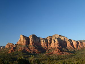
Sedona is the center of what is known as “Red Rock Country.”  The scenery is like an oasis when approaching from Phoenix.  Driving north through the desert, seeing your first glimpse of the red rock sandstone with green vegetation sprinkled about is a beautiful site.  For those traveling from Phoenix, your first red rock formation would be Bell Rock in the town of Oak Creek, a suburb of Sedona.

Sedona is a recreation paradise.  There are hundreds of miles of hiking trail and it is becoming famous for it’s mountain biking as well.  But what makes Sedona perfect is some amazing hotel spas and restaurant options.  Some restaurants that should not be missed are The Hudson, Elote and Saltrock.  These are my top three and I would happy eating at each one exclusively.

Yes, the desert is harsh but Sedona is home to Oak Creek, a river that runs year round.  There are several places to enjoy the cool water for a swim at Slide Rock State Park and Red Rock Crossing-Crescent Moon Park.

I would also recommend taking the time to enjoy a Sedona sunset.  Often this is overlooked as people head out for dinner.  But the sunsets are spectacular.  Some of my favorite places to watch sunset is from the summit of Doe Mountain, the summit of the Cockscomb or the summit of Little Sugarloaf Mountain which is the easiest to get to but still requires some hiking.


0

Category: Arizona

Cochise Stronghold Trail

A remote but wonderful hike through unique rock formations in the Dragoon Mountains.

I’ve always wanted to hike this and finally had the opportunity. Cochise Stronghold is about 1 hour from Tucson and well worth the drive. This is an out and back hike which makes for a long day hike. Guide books have it at 4.5 miles one way but it is longer. From where I parked my car, my GPS put the round trip at 12 miles. The entire hike I didn’t see one person. Great for some solitude, not so great if you have an accident and need help.

Be prepared with plenty of water.  The hike is relatively easy except for the length and heat of day.  Trail conditions are great and route finding easy. The trail is flanked by unique rock formations.  The entire way all I can think of was Cochise and the Apache Indians using this area as a hide out.

About half way you top out at Stronghold Divide.  The trail continues on down hill to East Stronghold Canyon Road.  I continued down for a long out and back.  You can easily turn back at the Pass for a shorter trip.

Directions: Take rt 10 east toward Benson and onto Cochise. Follow sign to Pearce then to Sunsite. Take Ironwood rd, forest rd 84 for about 12 miles to the Stronghold campground.


0

Category: Arizona

Puebla La Plata Ruins

Pueblo La Plata is the largest ancient Indian ruin in Agua Fria that dates back to before 1200 A.D. The ruin at one time had 80 to 90 rooms for living quarters of the people. Now the sight seems like just a pile of rubble. However there is significant research continuing on the mesa of Agua Fria which has about 400 sites. The community was quite large.

Today, few people visit the site because of the difficulty to get here. A high clearance 4×4 is required to get to the trailhead or you can walk the 2 mile road from Bloody Basin Road. There are many artifacts remaining in the area. Please practice “Leave No Trace” principles and do not take anything from the site. By the way, it is illegal to remove artifacts from an archeological site on federal land.

Directions: Exit 259 off Route 17 from Phoenix. Turn right on Bloody Basin road and follow for 8.5 miles. Pueblo La Plata is on the left and a sign marks the way.

0

Category: Arizona

Badger Spring Trail

Badger Spring Wash is a dry stream bed most of the year. This trail starts from the Badger Spring Trailhead just off Route 17 north of Phoenix. The trail follows the stream bed, sometimes in or along side for 1.5 miles. At about one mile, you reach the spring and a good amount of water which is surprising to find in the desert. The main trail is to the left along a rock outcropping.

Continue along the trail on the left and avoid the open boulder field. Many people miss the trail on the left. Watch for small cairns showing the way. Return the way you came. Be sure to explore the right side of the trail split. There is more water on that side and several places to camp.

After about hiking for 1 mile on the Badger Spring Trail you arrive at a confluence. Water on the right and a wash to the left. On the left side of the trail is a large rock outcropping. At the middle and near the top is very good examples of early American Indian petroglyphs. I think the ones near the top are best. You can easily walk right by them but just watch for that rock cliff right on the left side of the trail. The rock art may have been done by early Yavapai or the Perry Mesa Tradition Indian who settle the area in 1250 A.D.

The fork on the left is the main trail up the canyon. To the right is a lower wash that had a good amount of water, even in late May. To explore the lower wash, cross over the wash and hike along the bank of the water. The wash turns a corner and opens to a lush plant area. It is a beautiful relaxing spot that offers some shade. There are a few dispersed camping spots. A nice side trip to explore.

One of the best times to hike the Badger Spring Trail in late May or early June. During this time, desert flowers are in bloom, especially the Prickly Pear Cactus. The Prickly Pear can bloom in either yellow, red or purple flower. All the Prickly Pear in Badger Spring seem to bloom in yellow. Another flower in abundance along Badger Spring is the Smooth Threadleaf Ragwort.

0